
WoodlandCalc mapping
By mid-2012 the Woodland Potential Calculator had grown from a north-west trial into a national tool. The surviving figures from that summer are the map, not the meeting table: a National Character Area drawn over a satellite base, with a second outline for the wider landscape unit.
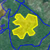
The yellow fill is the area under discussion. The blue line is the context around it. That pairing is what the meeting needs: enough of a map to know which hills you are talking about, without turning the session into a GIS lesson. NASA Blue Marble and Ordnance Survey OpenData sat underneath; the Forestry Commission’s own land-use research supplied other backdrops.
The full story of the commission is on the WoodlandCalc project page.