
Woodland Potential Calculator
In 2010 the Forestry Commission and Natural England set out to judge how much new woodland the north west of England could reasonably take. The region was split by landscape type using Natural England’s National Character Areas. Local experts would meet for each area and write down opportunities and constraints. Someone had to turn those meetings into a dataset.
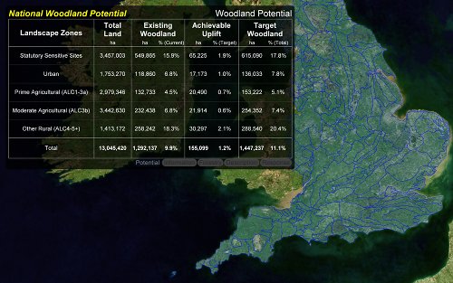
Michell Computing had already built presentation and distribution tools for the Forestry Commission and was invited to tender for the software.
The brief
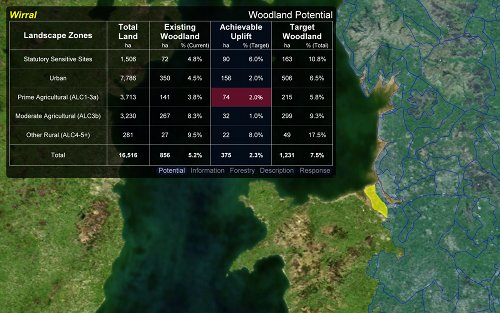
The application had to work in a meeting: large enough to present, still able to take figures typed into an on-screen table. An unknown number of people would use it, send their files back as email attachments, and the coordinator would combine them into a regional picture. A location map was desirable, not required.
First trials used VBA in PowerPoint and Excel. Each attempt hit a wall, and the best mapping we could offer that way was a set of static pictures. We switched to a small bespoke program, reusing mapping code from earlier GIS work and an open source graphics library. A proof of concept won the commission.
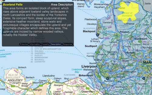
The first meeting date was close, so the cycles were short. Staff at both agencies gave precise feedback and a stable build was ready in time. The north-west trial worked well enough that both agencies asked for England. Through 2011 the program grew national mapping, extra background layers, and a cleaner presentation of each character area. It then became the tool for the National Woodland Potential dataset.
How it was built
The in-house mapping engine began in Delphi and was ported to Free Pascal and Lazarus years before this job. The full engine was too large to drop in wholesale, but it supplied tested code for drawing geometry and reading Well Known Text. Graphics came from Graphics32, also a Delphi library that had been ported to Free Pascal.
Background maps came from several places. The satellite layer is NASA Blue Marble. Other backdrops were built from Ordnance Survey OpenData. Land-use layers came from the Forestry Commission’s own research.
This was the first fully open source commercial project undertaken by Michell Computing. The application and its source are on SourceForge.